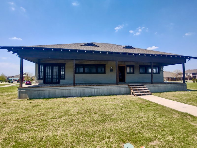
Built in 1912 by local farmer and inventor William E. Stone, the Stonehaven House is one of the few surviving examples of Prairie School architecture in Wylie. Known for its horizontal lines, low-pitched roof, and open interior, the home represents a meaningful chapter in the city's architectural history.
When development encroached on the original site, the City of Wylie made the decision to relocate the house approximately 400 feet to a new location in a nearby public park. Protecting the structure from demolition and preserving it for potential future use. Unfortunately, the move wasn’t without setbacks. The home’s original fireplace was destroyed during transport, and no existing construction documents or blueprints were available.
To move forward with restoration and long-term repurposing, the city needed accurate documentation of the house in its as-is condition. Both to understand the scope of work and to pursue restoration funding.
HosScans was brought in after the relocation to provide high-resolution 3D scanning and mapping of the structure in its new location. Using our NavVis MLX LiDAR platform, we captured a full interior and exterior scan of the house. Down to structural details, material textures, and alignment with the new site.
From this scan, we developed a comprehensive as-built graphic site plan tailored to the city’s needs. This document includes:
Scaled floor plan and building footprint
Orientation and positioning on the new lot
Visual references from scan data
Integration-ready formats for planners and city engineers
This deliverable serves as a crucial foundation for ongoing planning, budget estimation, and coordination with architects and contractors.
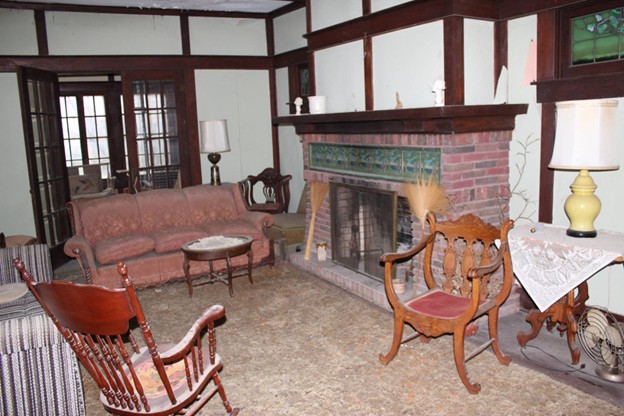
While the fireplace was unfortunately destroyed during the move, our LiDAR data captured the remaining structural context and surrounding surfaces. Once funding is secured and restoration moves into a new phase, we plan to generate a digital reconstruction of the original fireplace. Allowing for accurate rebuilding based on historic form and proportion.
Supporting City Funding Efforts: Our as-built plan provides clear, visual documentation that strengthens the city’s case when applying for grants or allocating municipal funds.
Real Data for Real Planning: Instead of relying on assumptions or incomplete records, planners now have millimeter-accurate site data to guide the next steps.
Scalable Preservation Workflow: Whether it’s planning adaptive reuse, rebuilding the fireplace, or future structural improvements, the digital foundation we’ve created will support the project every step of the way.
Historic photos and reference images of the Stonehaven House used with credit to Preservation Texas. Information sourced from Preservation Texas, “Stonehaven House,” accessed July 2025.
The Stonehaven House is more than a structure, it’s a tangible link to Wylie’s early identity and growth. By investing in accurate documentation and data-driven planning, the City of Wylie is ensuring this piece of history isn’t just preserved, but positioned for meaningful reuse.
At HosScans, we’re proud to provide the technology and expertise that help communities like Wylie bring the past into the future with clarity, accuracy, and purpose.
Historic photos and reference images of the Stonehaven House used with credit to Preservation Texas. Information sourced from Preservation Texas, “Stonehaven House,” accessed July 2025.