Powered by the NavVis Ecosystem, our scans are fast, accurate, and built for professionals who expect industry leading results. With HosScans, you get fast turnaround, crystal-clear scans, and a team that knows the job site isn’t a guessing game.
before-id-2849
Slide the bar from left to right to interact.
Share Point Cloud Data
RCP files for effortless BIM integration, and real time stakeholder access to monitor progress. It's all designed to streamline communication, reduce project costs, and fully document your portfolio with confidence.
Instant Virtual Access
With this powerful addition, we now offer complimentary 3D virtual access to your site for the duration of your project, allowing real time remote access to your asset. No delays, no guesswork.
Plan With Confidence
Our scans surface design conflicts and capture real world conditions early, so your team stays aligned, and your timeline stays intact. Accurate documentation supports better coordination, fewer delays.
Connect and Collaborate
This cutting edge solution features remote measurement tools for precise planning, virtual walk through's for seamless navigation and team collaboration, downloadable
Scanning Nationally, Trusted Locally
Our Proffessional Deliverables
Your project starts with us
Online Access. Anytime.
Get online virtual access to your scanned space. HosScans provides a shareable digital twins so teams, clients, and officials can view the site anytime, from anywhere.
Fast team alignment
Measurement tools
Reduces travel cost
Ready to Learn More?
Check out our NaVvis IVION Guide Page for more information!
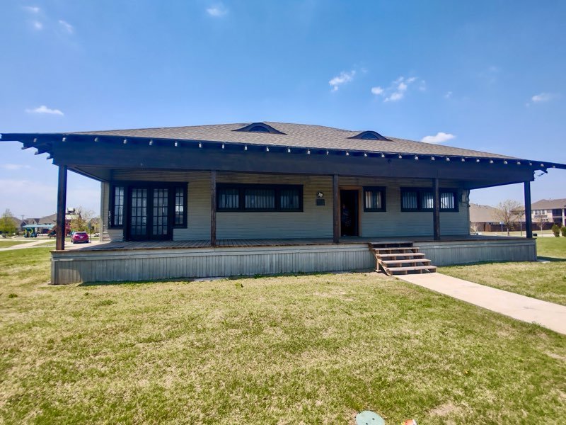
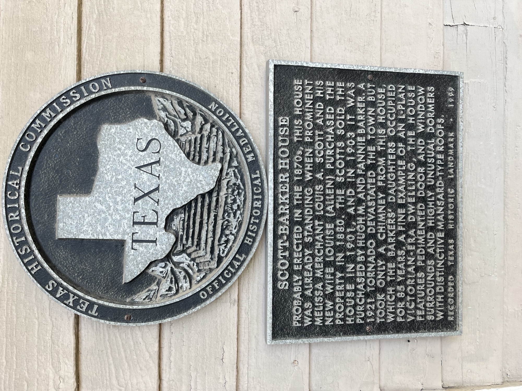
The Stonehaven House stands as a rare survivor of Wylie’s rural architectural heritage. Thanks to proactive scanning and data preservation, it can now be restored not just in structure, but in spirit.