Online Only Promotion - 5% off any services if you book through our website


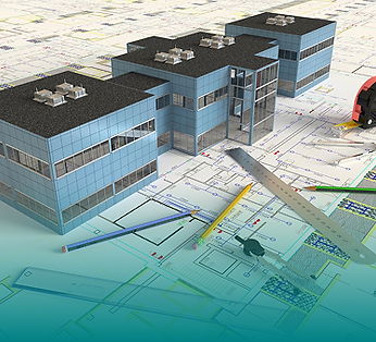
Dimensioned Floor Plans & Elevation Services in Dallas-Fort Worth
Dimensioned Floor Plans and Elevations Extracted from Reality
HosScans produces dimensioned floor plans and interior/exterior elevation drawings for Dallas-Fort Worth properties, extracted directly from LiDAR point-cloud data — CAD-ready, ±5mm verified, with no hand-measuring or guesswork.
5M+ Sqft Scanned
CAD-Ready .DWG Format
5-10 Days Turnaround

What Are As Built Dimension Plans?
2D Drawings Derived from 3D Reality
Dimensioned plans (often shortened to DIM plans) are accurate 2D floor plans with extensive interior and exterior dimensions, produced by extracting measurements from high-resolution LiDAR point cloud data. They're a step up from traditional hand-measuring, capturing the conditions of existing structures down to millimeter precision.
You can use these drawings as the foundation for a broad range of projects, including renovation design, space planning, lease documentation, permitting, and construction coordination. When your project depends on accurate dimensions and guesswork won't cut it, DIM plans should offer exactly what you need.
Good to know: DIM plans focus on interior/exterior layouts.
.png)
Measured From Reality
Every dimension we deliver comes from LiDAR-captured point cloud data, so you can develop design concepts without relying on assumptions or outdated records.
.png)
CAD-Compatible
Our dimensioned plans are delivered in .DWG format, ready to import into AutoCAD, Revit, or whatever your preferred design software may be.
.png)
Immediately Usable
You'll receive plans that are formatted, dimensioned, and organized for professional use. That means you don't have the hassle of processing raw data yourself.

What's Included in LiDAR Scanning & Elevations
We'll scope every project to your specific needs. Here are the drawing types we typically deliver:
-
Wall-to-wall dimensions
-
Door and window locations with sizes
-
Column grid and structural elements
-
Room labels and area calculations
-
Furniture and fixture locations (when requested)
Here's a breakdown of what you'll receive:
Complete floor plans showing walls, doors, windows, columns, and major architectural features with accurate dimensions. Our dimensioned floor plans include room labels and square footage calculations, as well as all the other key measurements that your team needs, clearly showing how spaces function and flow.
Dimensioned Floor Plans


.jpg)


Who Needs LiDAR Scanning?
Our DIM plans are intended for use by architects, construction teams, real estate companies, structural engineers, and facility management services. Regardless of your role, if your work depends on knowing exact dimensions, you'll appreciate the clarity of having these construction drawings to refer back to at any time.
Let's take a closer look at who our dimensioned plans are for.
.png)
Architects & Designers
Starting a renovation project without accurate existing conditions? Using DIM plans will give you a precise baseline for your design process, so you can avoid any unwanted field verification surprises. They also support interior design services.
-
Renovation and adaptive reuse projects
-
Space planning and programming
-
Code compliance verification
-
Historic building documentation
.png)
Contractors & Construction Managers
Bidding on a project with questionable drawings? You can reduce your bid risk by using DIM plans that document actual conditions before pricing. They'll also simplify coordination during any construction work.
-
Pre-bid existing conditions verification
-
Subcontractor coordination
-
Prefabrication planning
-
As-built record documentation
.png)
Commercial Real Estate Professionals
Marketing a property or negotiating a lease? You can use DIM plans to obtain accurate floor plans for listings and verify square footage for transactions. These plans also offer space planning support for tenants.
-
Marketing floor plans for listings
-
Lease exhibit documentation
-
Square footage verification
-
Tenant space planning support
.png)
Facility Managers & Property Owners
Managing a building without current drawings? DIM plans create a documented baseline that you can use for everything from maintenance planning to space management and future renovations.
-
Facility documentation updates
-
Space utilization analysis
-
Maintenance and operations support
-
Capital planning documentation
Accuracy You Can Trust
When you choose HosScans for your as-built products (including dimension plans, elevations, reflected ceiling plans), you know you're not just getting approximations. Our plans are extracted from survey-grade LiDAR point cloud data, so they're ideal when you need to bring your vision to life with a high level of accuracy. For instance, if you're:
A designer who needs exact dimensions for millwork and custom fabrication
Responsible for a property transaction, which depends on accurate square footage
Responsible for a property transaction, which depends on accurate square footage
Involved in permitting, which requires documented existing conditions
Leading a historic preservation project that demands precise architectural documentation
All our drawings go through a strict quality control process before we deliver them to you. Here, we'll verify dimensions and check for completeness, confirming that the drawings meet professional standards.

Verified against source data
%201.png)
Internal review before delivery
.png)
Corrections at no additional cost under 100% Satisfaction Guarantee

.png)

Why Choose HosScans For 3D Laser Scanning?
Many scanning companies deliver raw data, leaving your team to figure out how to use it. HosScans goes further, verifying conditions on-site and producing actionable as-built drawings and digital models.
The information we provide is immediately usable for everything from design and construction to property management and facility planning. Our scans are precise and reliable, tailored to how your team works.
Primary Format:
DWG (AutoCAD) — Native CAD format, fully editable, layer-organized
PDF — Scaled, print-ready drawings for review and distribution
Additional Formats (upon request):
CAD — Fully editable CAD files with organized layers
DXF — Universal CAD exchange format
RVT— Revit format (for BIM integration projects)
All our drawings have logical layer organization that follows industry conventions. We separate walls, doors, windows, dimensions, annotations, and other elements, so you can easily edit and customize your plans.
How It Works
We've designed our process to deliver accurate drawings efficiently, without disrupting your operations. Here's how the process works, from initial consultation to delivery.
%204.png)
STEP 1
Quote & Scope
We'll start by establishing which drawings you need and the level of detail required, as well as your timeline. We'll use this information to create a clear quote that covers all deliverables.
%201.png)
STEP 2
Site Scanning
Our team will then capture your space using our LiDAR scanning technology. We can scan most buildings in a single site visit, and we'll always aim for minimal disruption.

STEP 3
Point Cloud Processing
Next, we'll register and process this raw scan data into a unified, accurate point cloud, which serves as the foundation for all drawing extraction.

STEP 4
Drawing Production
Now the drawing production can begin. Our team will extract data including floor plans and elevations from the point cloud, then add annotations and layer organization.
%201.png)
STEP 5
Quality Control
When the work is finished on our end, we'll carefully review each drawing for accuracy and completeness, checking that formatting is professional, before delivery.
%202.png)
STEP 6
Delivery & Support
Finally, we'll send your drawings to you in your requested formats. We'll take this time to walk you through the deliverables and address any questions you might have.
We deliver most projects to our clients in 5-10 business days. We also offer expedited delivery within 24-72 hours for urgent projects.
LiDAR Scanning vs. Traditional Measuring
If you're wondering why you should choose LiDAR-based DIM plans over traditional hand-measuring or relying on existing drawings, it helps to understand what sets them apart. We've outlined the key differences between these options in the table below.
.png)
Pricing That Fits Your Project
The cost of our DIM plans pricing depends on a few factors, including the size of the structure, the complexity of the job at hand, and the specific drawings that you need.
Rest assured that we'll always provide clear, upfront quotes prior to any agreements, with no hidden fees, so can accurately budget for your project from the start.
How Our Pricing is Determined
Here are some of the key factors that affect pricing:
Total square footage
Number of floors
Drawing types needed (floor plans, elevations, sections)
Level of detail required
Turnaround timeline (standard vs. expedited)
Frequently Asked Questions
Why Teams Choose HosScans for LiDAR Scanning?
Our DIM plans are used across thousands of successful projects spanning renovation, leasing, design coordination, and construction workflows. Here are the key reasons why teams
Survey-grade precision on every drawing
CAD-ready, with .DWG format, layer-organized drawings that are immediately editable
Proven experience across building types, with 5M+ sqft documented
Revisions at no additional cost under our 100% Satisfaction Guarantee
AIA Dallas Allied Member, recognized by the architecture community
5-10 Day turnaround, allowing for fast delivery without sacrificing quality

.png)
.png)
.png)
